Volunteers Sought for Humanitarian Mapping ProjectsBy Tammy Daniels, iBerkshires Staff
10:22PM / Tuesday, September 16, 2014 | |
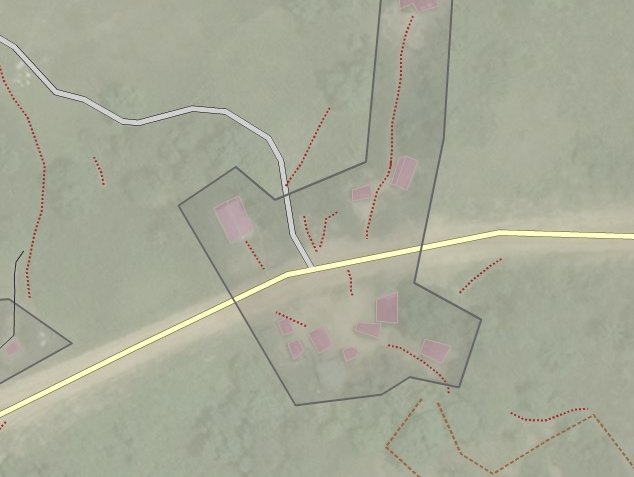
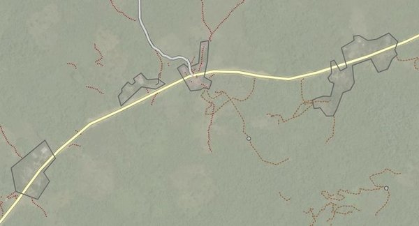 Satellite images are used to identify landmarks that are overlaid on a shareware mapping program. Satellite images are used to identify landmarks that are overlaid on a shareware mapping program. |
 Volunteers are plotting uncharted territories in West Africa as part of a crowdsourced mapping project to help health care workers with the ebola crisis. Two workshops are being offered this week on the project. Volunteers are plotting uncharted territories in West Africa as part of a crowdsourced mapping project to help health care workers with the ebola crisis. Two workshops are being offered this week on the project. |
PITTSFIELD, Mass. — Doctors and health-care workers trying to contain the ebola outbreak in West Africa are looking for direction from Internet savvy volunteers around the world.
A crowdsourced mapping project is helping them locate small villages and pathways in the poorly charted region to bring aid to isolated populations and track the spread of the disease. And it's not just being used for the ebola, but for humanitarian crises of all stripes.
That prompted Theresa Clary of Pittsfield to get involved — and to develop workshops to help others learn how to do humanitarian mapping.
"I am one of just a small group of people doing it," she said last week. "I saw on a major network [a segment] talking about this .. it's similar in concept to what Wikipedia does. ... He said they were using these maps and anyone could do it. ...
"I thought I could help recruit the average guy on the street and not be intimidated by it."
Clary, a consultant in geographical work force mapping, thought her background and experience fit well with teaching others how to use the satellite mapping process.
She's offering two free workshops this week on how to contribute: the first on Wednesday, Sept. 17, at 7 at the Starr Library in Rhinebeck, N.Y., and the second in Pittsfield on Thursday, Sept. 18, in Father Leonard Hall at St. Mark's Church, also at 7 p.m. More information can be found at www.MapHome.com, which will be updated as workshops are scheduled.
Those interested in attending should be computer literate and comfortable using the Internet and have access to those items at home, and be able to bring a laptop to the workshop.
"Ten years ago, we couldn't have done this," Clary said. "These organizations submit a request to a shareware website ... they're looking for volunteers all over the world to work with this."
Volunteers search the satellite images and aerial photographs for signs of habitation, roads and paths, then overlay the plots using the mapping software. The work gets "better and better" as more mappers confirm locations and roads, she said.
"The people there [in Africa] are using this help to help them on the front lines," Clary said.
"That's exactly why I started this ... so much of Africa is not mapped. Hands-on is what they need to get out there and educate the people [on the ground]. That's were the collaborative mapping comes in."
About a thousand people are now working on the project. Doctors Without Borders' "Missing Maps Project" is using collaborative mapping to track the spread of ebola and hope "to be the biggest instance of digital volunteerism the world has ever seen."
"When you come to the workshop, you can see how the dense the forest is and how much is not mapped and you get a sense of the value about the initiative," said Clary.
She's hoping more organizations will come on board to defray costs — the workshops may be free but they require space, power and Internet access; computers also are helpful — and provide support for advertising and administration.
"There are groups in Bosnia, Ukraine, these are all nonprofits doing humanitarian work," she said. "Why would someone not want to do this?
"We're all interconnected by a simple flight."
|

 MEMBER SIGN IN